 This application was created by the City of Port Adelaide Enfield to share its collection of historical photographs and aerial mapping with the community. The pictorial collection can also be viewed via our
.
Our
contains more information about the project and how you may donate photos or images to our collection.
This application was created by the City of Port Adelaide Enfield to share its collection of historical photographs and aerial mapping with the community. The pictorial collection can also be viewed via our
.
Our
contains more information about the project and how you may donate photos or images to our collection.
Port Adelaide Enfield Local History Photos
Application Help
Note: This help describes the desktop application. The application may behave slightly differently on smaller devices.
Using our web application you can view our historical photographs and aerial mapping.
All photographs are organised into Collections of photos such as Buildings, People or Places. Within these collections are subcategories called Albums.
Each photo has been placed on the map at the location where they were taken.
Browsing the Photos
You can view the photographs in several ways:
By selecting "Albums" from the top tool bar and
then selecting a collection and album of interest. ![]()
When you select an album, the images from
that album will be placed on the map. Selecting a blue marker will open a
popup displaying the image details. Where many markers lie close together, they
are represented by a circular cluster showing the number of markers within it. Clicking
on a cluster marker will zoom closer in to separate the cluster into it's
separate blue markers. Each blue marker represents a single photo that you can
click and view.
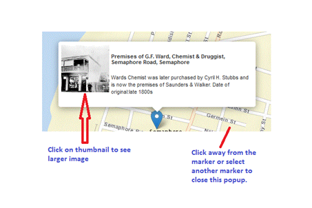
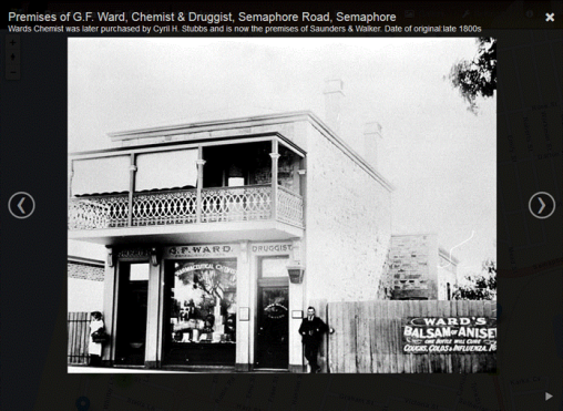
Clicking on the image thumbnail displays the photo in a full screen gallery. You
can view and step through all of the photos from the set in this gallery. Close
the gallery window and you are taken back to the map.
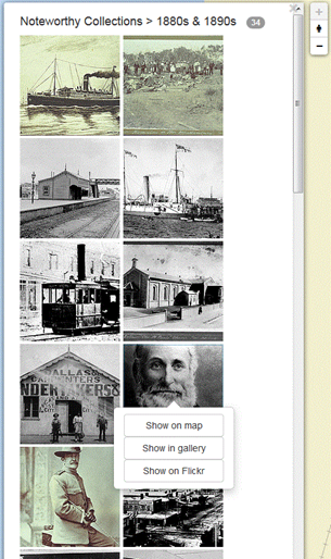
Photos can also be browsed by selecting “Gallery” in the top
tool bar
![]()
you are able to quickly scroll through the current album of photos quickly at the
left of the screen. By selecting one of these images you are provided the
option to view the image on the map, in gallery mode or on our Flickr page.
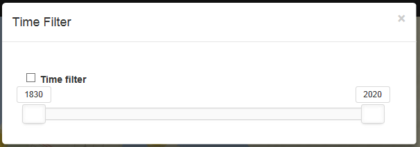
Using the Time filter
Time filter is accessed via the Filter tool.
The time filter is not available on smaller resolution devices.
The Time filter tool enables the display of photograph markers
to be filtered by a selected range of years.
Set your date range with the slidebar and click on the Time Filter checkbox to
enable filtering.
Viewing and Comparing Aerial Photography
Aerial photography is accessible at the bottom right of the map window

Different years of aerial can be seen by holding the mouse down on a year number and sliding it across the map and releasing.
Multiple years of aerial imagery can be dragged across to enable comparison between the years.
